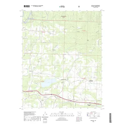
2020 Map of Watalula
USGS Topo · Published 2020About this map
Watalula and the surrounding highlands of the Ozark National Forest are defined by a network of rural cemeteries and creek drainages that tell the story of long-standing community roots. A sequence of family and community burial grounds, including Roger Cem, Harris Cem, Westview Cem, and Bell Cem, are scattered across the terrain, often located near the winding course of N Fork White Oak Cr. In the southern portion of the map, the landscape transitions toward the municipal infrastructure of Ozark, featuring the Ozark-Franklin County Airport and the recreational waters of Ozark City Lake. The inclusion of Wiederkehr Village highlights the area's viticultural identity, while landmarks like Mt Ephraim and Douglas Mtn provide significant elevation markers overlooking the Mulberry Wild and Scenic River corridor in the northwest corner.
Find a feature on this map
80 named features on this map. Tap any name to fly to it.
Don’t see what you’re looking for? This feature index may not catch every label — zoom into the map to look around manually.
Map Details
Editions of this 2020 Watalula Map
This is the sole edition of this map. No revisions or reprints were ever made.
Other maps of this area

1879 · Cravens
USGS Topo · 1:62,500

1887 · Magazine Mountain #1
USGS Topo · 1:62,500

1887 · Magazine Mountain #2
USGS Topo · 1:62,500

1887 · Watalula
USGS Topo · 1:62,500

1887 · Magazine Mountain
USGS Topo · 1:62,500

1890 · Magazine Mountain
USGS Topo · 1:125,000

1906 · Batson
USGS Topo · 1:62,500

1939 · Watalula
USGS Topo · 1:62,500

1956 · Russellville
USGS Topo · 1:250,000

1961 · Coal Hill
USGS Topo · 1:24,000