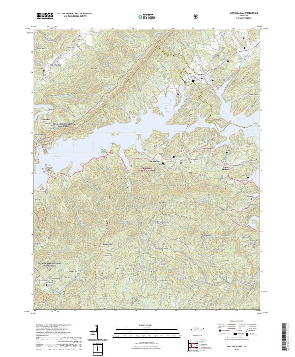
2022 Map of Watauga Dam
USGS Topo · Published 2022About this map
Watauga Lake dominates this mountain landscape, a reservoir that reshaped the local geography of the Iron Mountains within the Cherokee National Forest. The map documents the high-elevation settlements and family landmarks of eastern Tennessee, where ridges like Mays Ridge and Sheffield Ridge divide numerous hollows. The Appalachian National Scenic Trail winds through the terrain, passing landmarks such as Firescald Knob and Bear Stand. Cultural history is well-preserved through a dense concentration of family burial grounds, including the Matherly Cem, Wagner Cem, and Cochran Cem near the town of Butler. This geography illustrates the complex relationship between the natural water systems of the Watauga River and the rural communities like Fish Springs and Little Milligan that persist along the shoreline and deep within the surrounding gaps.
Find a feature on this map
133 named features on this map. Tap any name to fly to it.
Don’t see what you’re looking for? This feature index may not catch every label — zoom into the map to look around manually.
Map Details
Editions of this 2022 Watauga Dam Map
This is the sole edition of this map. No revisions or reprints were ever made.
Other maps of this area

1891 · Roan Mountain
USGS Topo · 1:125,000

1893 · Cranberry
USGS Topo · 1:125,000

1894 · Roan Mountain
USGS Topo · 1:125,000

1895 · Cranberry
USGS Topo · 1:125,000

1899 · Cranberry
USGS Topo · 1:125,000

1902 · Cranberry
USGS Topo · 1:125,000

1904 · Roan Mountain
USGS Topo · 1:125,000

1934 · White Rocks Mtn
USGS Topo · 1:24,000

1934 · Iron Mtn Gap
USGS Topo · 1:24,000

1934 · Elk Park
USGS Topo · 1:24,000