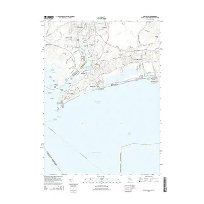
2015 Map of Watch Hill
USGS Topo · Published 2015About this map
The Pawcatuck River serves as a natural boundary between Connecticut and Rhode Island in this coastal survey, where the river meets Little Maschaug Pond and the Atlantic Ocean. The settlement pattern is defined by historic shorefront communities and recreational landmarks, ranging from the residential streets of Pawcatuck and Westerly to the seasonal destination of Watch Hill. Local heritage is preserved in sites like Saint Sebastian Cem and River Bend Cem, while the region's mid-century aviation and maritime infrastructure is represented by the Westerly State Airport and the New London-Block Island Ferry route. Along the coastline, expansive public and private beaches including Misquamicut State Beach and Ocean House Beach illustrate the area's long-standing identity as a premier New England seaside retreat.
Find a feature on this map
91 named features on this map. Tap any name to fly to it.
Don’t see what you’re looking for? This feature index may not catch every label — zoom into the map to look around manually.
Map Details
Editions of this 2015 Watch Hill Map
This is the sole edition of this map. No revisions or reprints were ever made.
Other maps of this area

1889 · Stonington
USGS Topo · 1:62,500

1889 · Charlestown
USGS Topo · 1:62,500

1889 · Block Island
USGS Topo · 1:62,500

1893 · Stonington
USGS Topo · 1:62,500

1894 · Block Island
USGS Topo · 1:62,500

1899 · Block Island
USGS Topo · 1:62,500

1904 · Montauk
USGS Topo · 1:62,500

1919 · Charlestown
USGS Topo · 1:62,500

1921 · Charlestown
USGS Topo · 1:62,500

1921 · Stonington
USGS Topo · 1:62,500