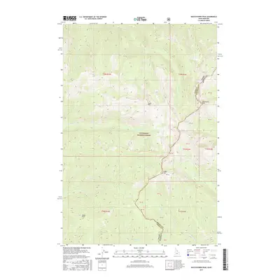
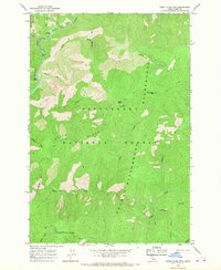
2017 Map of Watchtower Peak
USGS Topo · Published 2017About this map
Watchtower Peak and the high ridges of the Bitterroot National Forest dominate this high-altitude landscape along the divide between Idaho and Montana. The 2017 survey details a remote wilderness environment where water systems like Sheephead Cr and its N Fork Sheephead Cr drain the steep eastern slopes of the Bitterroot Mountains. The jurisdictional boundary between Idaho County and Ravalli County follows the erratic line of the crest, passing through prominent landmarks such as Cooper Point and Indian Hill. This modern topographic study reveals the natural drainages that define the area, including Schofield Cr, Indian Cr, and Cayuse Cr, which carve deep valleys through the forest. The lack of built infrastructure emphasizes the preserved state of this national forest land, where features like Saddle Gulch and Peach Cr offer specific points of reference for those navigating the backcountry or studying the hydrologic patterns of the Northern Rockies.
Find a feature on this map
20 named features on this map. Tap any name to fly to it.
Don’t see what you’re looking for? This feature index may not catch every label — zoom into the map to look around manually.
Map Details
Editions of this 2017 Watchtower Peak Map
This is the sole edition of this map. No revisions or reprints were ever made.
Other maps of this area

1956 · Elk City
USGS Topo · 1:250,000

1960 · Elk City
USGS Topo · 1:250,000

1960 · Painted Rocks Lake
USGS Topo · 1:62,500

1962 · Beaver Jack Mtn
USGS Topo · 1:24,000

1962 · Nez Perce Peak
USGS Topo · 1:24,000
1964 · Mount Jerusalem
USGS Topo · 1:24,000
1964 · Tin Cup Lake
USGS Topo · 1:24,000

1966 · Watchtower Peak
USGS Topo · 1:24,000
1966 · Mount Paloma
USGS Topo · 1:24,000
1966 · Burnt Strip Mtn
USGS Topo · 1:24,000