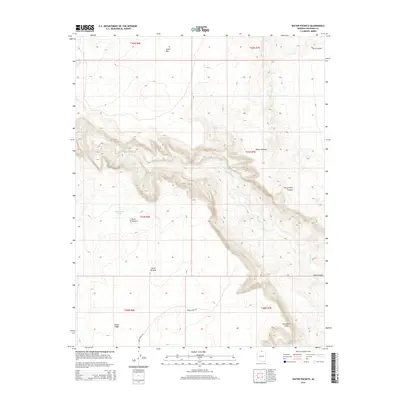
2014 Map of Water Pockets
USGS Topo · Published 2014About this map
The Paria River carves a deep path through this section of Coconino County, creating the dramatic geological formations of Paria Canyon and Ferry Swale Canyon. To the south, the Vermilion Cliffs rise sharply from the landscape, marking a significant transition in elevation near the Paria Plateau. This 2014 survey documents the isolated and high-relief character of the region, where water sources like Bush Head Tank and the namesake Water Pockets are critical features in an otherwise arid environment. Human presence is sparse, represented primarily by Horse Ridge Rd traversing the southern portion of the quadrangle. Significant landmarks such as Cedar Mtn, Horse Ridge, and Bush Head provide navigational points across this complex terrain of mesas and deep drainage systems north of the Colorado River corridor.
Find a feature on this map
18 named features on this map. Tap any name to fly to it.
Don’t see what you’re looking for? This feature index may not catch every label — zoom into the map to look around manually.
Map Details
Editions of this 2014 Water Pockets Map
This is the sole edition of this map. No revisions or reprints were ever made.
Other maps of this area

1886 · Escalante
USGS Topo · 1:250,000

1886 · Echo Cliffs
USGS Topo · 1:250,000

1891 · Echo Cliffs
USGS Topo · 1:250,000

1951 · Lees Ferry NE
USGS Topo · 1:24,000

1953 · Nipple Butte
USGS Topo · 1:62,500

1954 · Lees Ferry NW
USGS Topo · 1:24,000

1954 · Paria Plateau SE
USGS Topo · 1:24,000

1954 · Lees Ferry SE
USGS Topo · 1:24,000

1954 · Lees Ferry SW
USGS Topo · 1:24,000

1954 · Lees Ferry
USGS Topo · 1:62,500