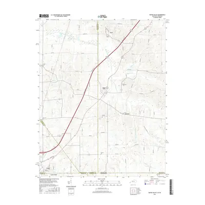
2016 Map of Water Valley
USGS Topo · Published 2016About this map
Water Valley and the community of Feliciana sit at the heart of this agricultural landscape in western Kentucky. The terrain is defined by the winding course of the Bayou de Chien and its tributaries, including Jackson Cr and the S Fork Bayou de Chien, which drain the low-lying bottoms. High-speed travel via the Purchase Pkwy bisects the region, cutting a modern path through older rural networks like State Hwy 2571. To the south, the map reaches the outskirts of Fulton and South Fulton at the Tennessee state line. Family and community heritage is deeply rooted here, evidenced by numerous burial sites including Camp Beauregard Cem, Pleasant Hill Cem, and the Wesley Cem. The proximity of Stephens Lake and several small creeks suggests a landscape where water management and drainage have long shaped land use and local settlement patterns.
Find a feature on this map
78 named features on this map. Tap any name to fly to it.
Don’t see what you’re looking for? This feature index may not catch every label — zoom into the map to look around manually.
Map Details
Editions of this 2016 Water Valley Map
This is the sole edition of this map. No revisions or reprints were ever made.
Other maps of this area

1952 · Clinton
USGS Topo · 1:24,000

1952 · Mayfield
USGS Topo · 1:24,000

1952 · Dublin
USGS Topo · 1:24,000

1952 · Crutchfield
USGS Topo · 1:24,000

1952 · Cuba
USGS Topo · 1:24,000

1952 · Water Valley
USGS Topo · 1:24,000

1952 · Mayfield
USGS Topo · 1:62,500

1952 · Water Valley
USGS Topo · 1:62,500

1956 · Harris
USGS Topo · 1:24,000

1956 · Mc Connell
USGS Topo · 1:24,000