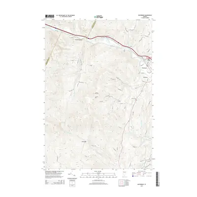
2015 Map of Waterbury
USGS Topo · Published 2015About this map
Waterbury and the neighboring settlements of Duxbury and Mill Village anchor this landscape where the Winooski River meets the Little River. The topography is dominated by the Green Mountains, with steep elevations rising toward Crosset Hill and Crossett HL. For genealogists and local historians, several upland burial grounds are documented, including Graves Cem and the Phillips-Duxbury Hill Cem. The settlement pattern follows the river valleys and mountain gaps, with smaller hamlets like North Duxbury and Duxville situated along key transit corridors. Numerous mountain streams such as Ridley Brook and Dowsville Brook carve through the terrain, draining into the larger river systems. The map also highlights the southern reach of the quadrangle near Moretown Falls on the Mad River, illustrating a region where rugged terrain and water power have long dictated the placement of roads and homesteads.
Find a feature on this map
78 named features on this map. Tap any name to fly to it.
Don’t see what you’re looking for? This feature index may not catch every label — zoom into the map to look around manually.
Map Details
Editions of this 2015 Waterbury Map
This is the sole edition of this map. No revisions or reprints were ever made.
Other maps of this area

1919 · Lincoln Mountain
USGS Topo · 1:62,500

1919 · Montpelier
USGS Topo · 1:62,500

1920 · Lincoln Mountain
USGS Topo · 1:48,000

1921 · Richmond
USGS Topo · 1:48,000

1921 · Lincoln Mountain
USGS Topo · 1:62,500

1921 · Montpelier
USGS Topo · 1:62,500

1922 · Barre
USGS Topo · 1:48,000

1924 · Barre
USGS Topo · 1:62,500

1924 · Camels Hump
USGS Topo · 1:62,500

1944 · Montpelier
USGS Topo · 1:62,500