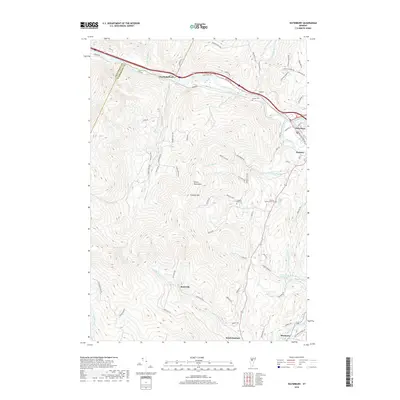
2018 Map of Waterbury
USGS Topo · Published 2018About this map
Waterbury and the Winooski River valley serve as the focal points for this 2018 survey of north-central Vermont. The landscape is defined by the steep rises of the Green Mountains, where the elevation climbs sharply away from the river floor toward summits like Crossett Hill. Local history is preserved in small hill settlements and rural burial grounds such as Crossett Hill Cem and the Phillips - Duxbury Hill Cem. The southern portion of the map transitions into the Mad River valley near Moretown, where Moretown Falls marks the river's descent. Notable for genealogists, the map identifies numerous family-named roads and remote reaches like Dowsville and North Duxbury, illustrating the persistent settlement patterns in this part of Washington County. Hydrographic features, including Bolton Falls and the Light Trout Club Lake, show the importance of water resources to both the industry and recreation of the region.
Find a feature on this map
85 named features on this map. Tap any name to fly to it.
Don’t see what you’re looking for? This feature index may not catch every label — zoom into the map to look around manually.
Map Details
Editions of this 2018 Waterbury Map
This is the sole edition of this map. No revisions or reprints were ever made.
Other maps of this area

1919 · Lincoln Mountain
USGS Topo · 1:62,500

1919 · Montpelier
USGS Topo · 1:62,500

1920 · Lincoln Mountain
USGS Topo · 1:48,000

1921 · Richmond
USGS Topo · 1:48,000

1921 · Lincoln Mountain
USGS Topo · 1:62,500

1921 · Montpelier
USGS Topo · 1:62,500

1922 · Barre
USGS Topo · 1:48,000

1924 · Barre
USGS Topo · 1:62,500

1924 · Camels Hump
USGS Topo · 1:62,500

1944 · Montpelier
USGS Topo · 1:62,500