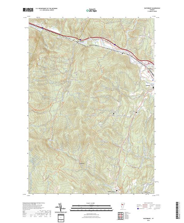
2024 Map of Waterbury
USGS Topo · Published 2024About this map
The Winooski River carves a critical corridor through the Green Mountains here, separating Chittenden County and Washington County. This landscape is defined by the sharp elevation changes between the river valley and prominent heights like Crossett Hill. The concentration of small family and community burial grounds, such as Landon - Hayden Cem and the Phillips - Duxbury Hill Cem, indicates a long history of upland settlement that persists alongside modern infrastructure.
Find a feature on this map
79 named features on this map. Tap any name to fly to it.
Don’t see what you’re looking for? This feature index may not catch every label — zoom into the map to look around manually.
Map Details
Editions of this 2024 Waterbury Map
This is the sole edition of this map. No revisions or reprints were ever made.
Other maps of this area

1919 · Lincoln Mountain
USGS Topo · 1:62,500

1919 · Montpelier
USGS Topo · 1:62,500

1920 · Lincoln Mountain
USGS Topo · 1:48,000

1921 · Richmond
USGS Topo · 1:48,000

1921 · Lincoln Mountain
USGS Topo · 1:62,500

1921 · Montpelier
USGS Topo · 1:62,500

1922 · Barre
USGS Topo · 1:48,000

1924 · Barre
USGS Topo · 1:62,500

1924 · Camels Hump
USGS Topo · 1:62,500

1944 · Montpelier
USGS Topo · 1:62,500