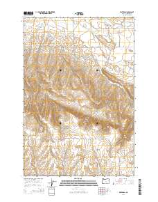
2014 Map of Waterman
USGS Topo · Published 2014About this map
Walla Walla Valley transitions into the rising terrain of the Blue Mountain foothills on this survey of Umatilla County. The small settlement of Waterman sits near the head of Waterman Gulch, while Umapine anchors the northern reaches of the sheet where the land flattens toward the state line. This landscape is defined by a complex network of water management, illustrated by early infrastructure like Love Loney Ditch, White Ditch, and the White Reservoir fed by Pine Cr. These irrigation systems and water sources such as Swartz Spring indicate the long-standing agricultural dependence on diverted mountain runoff. The map also documents numerous family-named roads, including Hudson Bay Rd, Buroker Rd, and Dickerson Rd, which trace the legacy of local land ownership and the evolution of rural transit patterns in the region.
Find a feature on this map
37 named features on this map. Tap any name to fly to it.
Don’t see what you’re looking for? This feature index may not catch every label — zoom into the map to look around manually.
Map Details
Editions of this 2014 Waterman Map
This is the sole edition of this map. No revisions or reprints were ever made.
Other maps of this area

1915 · Wallulah
USGS Topo · 1:96,000

1918 · Wallula
USGS Topo · 1:125,000

1919 · Walla Walla
USGS Topo · 1:125,000

1921 · Walla Walla
USGS Topo · 1:125,000

1935 · Pendleton
USGS Topo · 1:125,000

1953 · Pendleton
USGS Topo · 1:250,000

1953 · Walla Walla
USGS Topo · 1:250,000

1956 · Pendleton
USGS Topo · 1:250,000

1958 · Walla Walla
USGS Topo · 1:250,000

1964 · Milton-Freewater
USGS Topo · 1:24,000