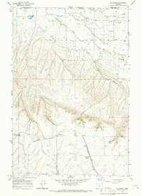
1966 Map of Waterman
USGS Topo · Published 1967About this map
The Northern Pacific railroad cuts through this portion of Umatilla County, connecting small agrarian shipping points along the high plateau south of the Walla Walla Valley. The small settlement of Waterman is anchored by a grain elevator, a critical piece of infrastructure for the local wheat economy during the mid-1960s. Nearby, the tracks pass through Wayland and Duroc, which also features a grain elevator, signaling the region's historical role in regional grain production and transport.
Find a feature on this map
18 named features on this map. Tap any name to fly to it.
Don’t see what you’re looking for? This feature index may not catch every label — zoom into the map to look around manually.
Map Details
Editions of this 1966 Waterman Map
This is the sole edition of this map. No revisions or reprints were ever made.
Other maps of this area

1915 · Wallulah
USGS Topo · 1:96,000

1918 · Wallula
USGS Topo · 1:125,000

1919 · Walla Walla
USGS Topo · 1:125,000

1921 · Walla Walla
USGS Topo · 1:125,000

1935 · Pendleton
USGS Topo · 1:125,000

1953 · Pendleton
USGS Topo · 1:250,000

1953 · Walla Walla
USGS Topo · 1:250,000

1956 · Pendleton
USGS Topo · 1:250,000

1958 · Walla Walla
USGS Topo · 1:250,000

1964 · Milton-Freewater
USGS Topo · 1:24,000