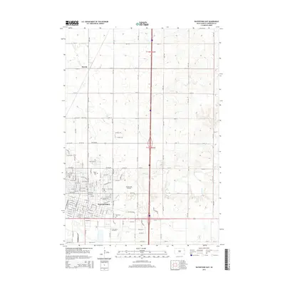
2015 Map of Watertown East
USGS Topo · Published 2015About this map
Watertown serves as the focal point of this 2015 survey, situated on the distinctive geological upland of the Coteau des Prairies. The city's residential and educational infrastructure is well-defined, including the campus of the Lake Area Technical Institute and the sprawling grid of streets such as 3rd St NW and 4th St NW. To the north, the small settlement of Rauville and the agricultural sections of t118n r52w illustrate the transition from urban center to the productive farmlands of Codington County.
Find a feature on this map
84 named features on this map. Tap any name to fly to it.
Don’t see what you’re looking for? This feature index may not catch every label — zoom into the map to look around manually.
Map Details
Editions of this 2015 Watertown East Map
This is the sole edition of this map. No revisions or reprints were ever made.
Other maps of this area

1953 · Milbank
USGS Topo · 1:250,000

1953 · Watertown
USGS Topo · 1:250,000

1958 · Milbank
USGS Topo · 1:250,000

1958 · Watertown
USGS Topo · 1:250,000

1969 · Watertown West
USGS Topo · 1:24,000

1969 · Pelican Lake
USGS Topo · 1:24,000

1969 · Watertown SE
USGS Topo · 1:24,000

1969 · Watertown East
USGS Topo · 1:24,000

1970 · Kranzburg SW
USGS Topo · 1:24,000

1970 · Kranzburg
USGS Topo · 1:24,000