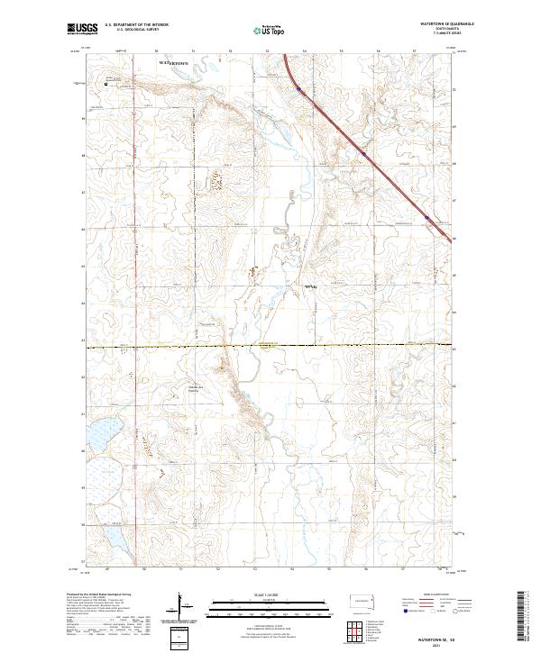
2021 Map of Watertown SE
USGS Topo · Published 2021About this map
The Big Sioux River winds through the heart of this landscape southeast of Watertown, illustrating the transition from the city's outskirts to the rural agricultural tracts of South Dakota. The eastern edge of the Coteau des Prairies plateau influences the local topography, creating a backdrop for smaller settlements like Appleby. To the north, the Mother of God Monastery Cem stands near the intersection of modern road networks including Meadow Lake Rd and 25th Ave S. The map details the hydrology of the region, from the meandering main river channel and its tributary Willow Cr to the collection of water bodies known as Five Ponds in the southwest. This record of the Codington County and Hamlin County line provides a precise look at the 2021 road grid and the rural properties that define the modern prairie economy.
Find a feature on this map
29 named features on this map. Tap any name to fly to it.
Don’t see what you’re looking for? This feature index may not catch every label — zoom into the map to look around manually.
Map Details
Editions of this 2021 Watertown SE Map
This is the sole edition of this map. No revisions or reprints were ever made.
Other maps of this area

1953 · Watertown
USGS Topo · 1:250,000

1958 · Watertown
USGS Topo · 1:250,000

1969 · Hayti
USGS Topo · 1:24,000

1969 · Dempster
USGS Topo · 1:24,000

1969 · Castlewood
USGS Topo · 1:24,000

1969 · Watertown West
USGS Topo · 1:24,000

1969 · Pelican Lake
USGS Topo · 1:24,000

1969 · Watertown SE
USGS Topo · 1:24,000

1969 · Watertown East
USGS Topo · 1:24,000

1970 · Kranzburg SW
USGS Topo · 1:24,000
Featured Places
- Watertown, SD
- Sheridan Township, SD
- Kranzburg South Township, SD
- Castlewood Township, SD
- Hamlin Township, SD