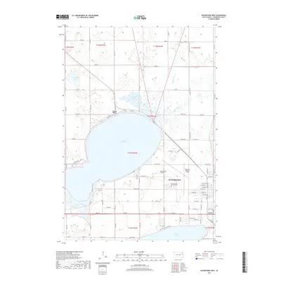
2017 Map of Watertown West
USGS Topo · Published 2017About this map
Lake Kampeska dominates this landscape, its broad waters ringed by the settlement of North Shore and a network of shoreline roads including N Lake Dr and S Lake Dr. Situated on the edge of the Coteau des Prairies, the western outskirts of Watertown reveal a transition from suburban development to the expansive agricultural grid of Codington County. Significant infrastructure like the Watertown Regional Airport sits just east of the lake, while the Big Sioux River and Mud Creek drain the surrounding prairie. Local history is anchored by landmarks such as the Mother of God Monastery Cem, and the presence of wetlands like Cottonwood Slough and Pelican Lake highlights the importance of the Glacial Lakes region's water resources in South Dakota's eastern plains.
Find a feature on this map
85 named features on this map. Tap any name to fly to it.
Don’t see what you’re looking for? This feature index may not catch every label — zoom into the map to look around manually.
Map Details
Editions of this 2017 Watertown West Map
This is the sole edition of this map. No revisions or reprints were ever made.
Other maps of this area

1953 · Milbank
USGS Topo · 1:250,000

1953 · Watertown
USGS Topo · 1:250,000

1958 · Milbank
USGS Topo · 1:250,000

1958 · Watertown
USGS Topo · 1:250,000

1969 · Watertown West
USGS Topo · 1:24,000

1969 · Pelican Lake
USGS Topo · 1:24,000

1969 · Watertown SE
USGS Topo · 1:24,000

1969 · Watertown East
USGS Topo · 1:24,000

1970 · Still Lake SE
USGS Topo · 1:24,000

1970 · Still Lake
USGS Topo · 1:24,000