
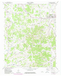
1958 Map of Watertown
USGS Topo · Published 1959About this map
Watertown serves as the primary rail hub in this mid-century survey of Wilson County, anchored by the Tennessee Central RR and the junction of Sparta Pike and Central Pike. The landscape is a mix of agricultural valleys and prominent heights like Mt Defiance and Walnut Hill, punctuated by small rural communities. Settlements such as Norene, Sherrilltown, and Statesville are clearly defined, often centered around local institutions like Norene Sch or Fall Creek Ch.
Find a feature on this map
54 named features on this map. Tap any name to fly to it.
Don’t see what you’re looking for? This feature index may not catch every label — zoom into the map to look around manually.
Map Details
Editions of this 1958 Watertown Map
2 editions found
Other maps of this area

1908 · Woodbury
USGS Topo · 1:62,500

1916 · Murfreesboro
USGS Topo · 1:62,500

1942 · Statesville
USGS Topo · 1:100,000

1942 · Lebanon
USGS Topo · 1:100,000

1951 · Lebanon
USGS Topo · 1:24,000

1956 · Vine
USGS Topo · 1:24,000

1956 · Columbia
USGS Topo · 1:250,000

1956 · Nashville
USGS Topo · 1:250,000
1957 · Lascassas
USGS Topo · 1:24,000

1958 · New Middleton
USGS Topo · 1:24,000