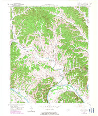
1953 Map of Waterview
USGS Topo · Published 1983About this map
The Cumberland River carves a deep path through southern Kentucky, creating the dramatic Salt Lick Bend and fertile lowlands like Whites Bottom. During the early 1950s, this area remained largely rural, centered on the county seat of Burkesville and smaller settlements such as Waterview, Grider, and Ellington. The landscape is defined by its water-dependent transport and topography, featuring river crossings like Cloyds Landing Ferry and Oliver Ferry that connected isolated communities before modern bridge infrastructure dominated the region.
Find a feature on this map
50 named features on this map. Tap any name to fly to it.
Don’t see what you’re looking for? This feature index may not catch every label — zoom into the map to look around manually.
Map Details
Editions of this 1953 Waterview Map
2 editions found
Other maps of this area

1924 · Lillydale
USGS Topo · 1:62,500

1926 · Lillydale
USGS Topo · 1:62,500

1929 · Lillydale
USGS Topo · 1:62,500

1929 · Tompkinsville
USGS Topo · 1:62,500

1953 · Breeding
USGS Topo · 1:24,000

1953 · Waterview
USGS Topo · 1:24,000

1953 · Edmonton
USGS Topo · 1:24,000

1953 · Amandaville
USGS Topo · 1:24,000

1953 · Burkesville
USGS Topo · 1:24,000

1953 · Dubre
USGS Topo · 1:24,000