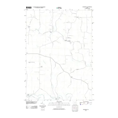
2010 Map of Waterville
USGS Topo · Published 2010About this map
Waterville serves as the primary hub of this Allamakee County landscape, situated where Paint Creek winds through the northern terrain. The area is defined by a series of small, historically distinct settlements including Maud, Egan, Volney, and the uniquely named Sixteen. Each community maintains its own identity, often centered around a church or burying ground, as evidenced by the high density of memorial sites such as the East Paint Creek Synod Cemetery and the IndependentOrder of Odd Fellows Cemetery.
Find a feature on this map
45 named features on this map. Tap any name to fly to it.
Don’t see what you’re looking for? This feature index may not catch every label — zoom into the map to look around manually.
Map Details
Editions of this 2010 Waterville Map
This is the sole edition of this map. No revisions or reprints were ever made.
Other maps of this area

1903 · Waukon
USGS Topo · 1:125,000

1929 · Ferryville
USGS Topo · 1:62,500

1929 · Prairie Du Chien
USGS Topo · 1:62,500

1932 · Ferryville
USGS Topo · 1:62,500

1932 · Prairie Du Chien
USGS Topo · 1:62,500

1958 · La Crosse
USGS Topo · 1:250,000

1961 · La Crosse
USGS Topo · 1:250,000

1965 · La Crosse
USGS Topo · 1:250,000

1966 · Ferryville
USGS Topo · 1:62,500
1967 · Prairie Du Chien
USGS Topo · 1:62,500