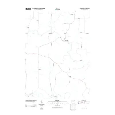
2013 Map of Waterville
USGS Topo · Published 2013About this map
Waterville serves as a central hub in this corner of Allamakee County, where the street grid includes local identifiers like Creamery St and Railroad Ln. The surrounding landscape is defined by the winding course of Paint Cr and the Yellow River, which provide the primary drainage and recreational corridors for the region. Small rural clusters like Rossville, Egan, and the curiously named Sixteen are connected by a network of ridge-top and valley roads, including Chimney Rock Rd and State Forest Rd. Notable crossing points like Monsrud Bridge and the Bridge Sixteen Canoe Access highlight the importance of water access in this driftless-style topography. The map also captures several family-named routes such as Jeglum Rd and Barr Dr, which reflect the long-standing agricultural heritage of the communities situated between the northern creek valleys and the southern river bottomlands.
Find a feature on this map
57 named features on this map. Tap any name to fly to it.
Don’t see what you’re looking for? This feature index may not catch every label — zoom into the map to look around manually.
Map Details
Editions of this 2013 Waterville Map
This is the sole edition of this map. No revisions or reprints were ever made.
Other maps of this area

1903 · Waukon
USGS Topo · 1:125,000

1929 · Ferryville
USGS Topo · 1:62,500

1929 · Prairie Du Chien
USGS Topo · 1:62,500

1932 · Ferryville
USGS Topo · 1:62,500

1932 · Prairie Du Chien
USGS Topo · 1:62,500

1958 · La Crosse
USGS Topo · 1:250,000

1961 · La Crosse
USGS Topo · 1:250,000

1965 · La Crosse
USGS Topo · 1:250,000

1966 · Ferryville
USGS Topo · 1:62,500
1967 · Prairie Du Chien
USGS Topo · 1:62,500