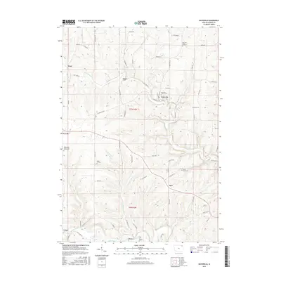
2015 Map of Waterville
USGS Topo · Published 2015About this map
Waterville and its surrounding Allamakee County townships are defined by the deep incisions of Paint Cr and the Yellow River, which carve through the high limestone plateaus of the Driftless Area. This 2015 update records the enduring rural footprint of small settlements like Maud, Egan, and the namesake village of Sixteen. Local genealogy and land history are anchored by numerous hilltop burial sites, including the East Paint Creek Synod Cem and the Cherry Mound Cem. The map illustrates the persistence of a road network that follows the winding ridge lines, such as Ness Ridge, or drops into the valleys where historical crossings like Monsrud Bridge connect agricultural lands. The distinct absence of urban sprawl highlights a landscape dedicated to long-term conservation and traditional farming, where the terrain itself dictates the location of crossroads like Rossville and Volney.
Find a feature on this map
65 named features on this map. Tap any name to fly to it.
Don’t see what you’re looking for? This feature index may not catch every label — zoom into the map to look around manually.
Map Details
Editions of this 2015 Waterville Map
This is the sole edition of this map. No revisions or reprints were ever made.
Other maps of this area

1903 · Waukon
USGS Topo · 1:125,000

1929 · Ferryville
USGS Topo · 1:62,500

1929 · Prairie Du Chien
USGS Topo · 1:62,500

1932 · Ferryville
USGS Topo · 1:62,500

1932 · Prairie Du Chien
USGS Topo · 1:62,500

1958 · La Crosse
USGS Topo · 1:250,000

1961 · La Crosse
USGS Topo · 1:250,000

1965 · La Crosse
USGS Topo · 1:250,000

1966 · Ferryville
USGS Topo · 1:62,500
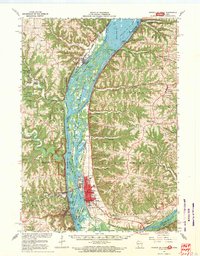
1967 · Prairie Du Chien
USGS Topo · 1:62,500