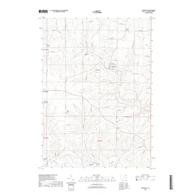
2018 Map of Waterville
USGS Topo · Published 2018About this map
Waterville serves as the central hub of this northeastern Iowa landscape, where the deeply carved valleys of Paint Cr and the Yellow River dictate the local geography. The settlement pattern follows these natural corridors, with smaller communities like Rossville, Egan, and Volney situated along the ridges and valley floors. For genealogists, the map is particularly rich in cemetery locations, documenting local heritage at the East Paint Creek Synod Cem, Waterville Lutheran Cem, and the uniquely named Independent Order of Odd Fellows Cem. The infrastructure is marked by several landmark crossings, most notably the Monsrud Bridge, and a network of roads like Chimney Rock Rd and Ness Ridge Rd that navigate the varied elevation. This survey provides a clear look at the rural township structure of t97n r4w and its neighbors during the early twenty-first century.
Find a feature on this map
69 named features on this map. Tap any name to fly to it.
Don’t see what you’re looking for? This feature index may not catch every label — zoom into the map to look around manually.
Map Details
Editions of this 2018 Waterville Map
This is the sole edition of this map. No revisions or reprints were ever made.
Other maps of this area

1903 · Waukon
USGS Topo · 1:125,000

1929 · Ferryville
USGS Topo · 1:62,500

1929 · Prairie Du Chien
USGS Topo · 1:62,500

1932 · Ferryville
USGS Topo · 1:62,500

1932 · Prairie Du Chien
USGS Topo · 1:62,500

1958 · La Crosse
USGS Topo · 1:250,000

1961 · La Crosse
USGS Topo · 1:250,000

1965 · La Crosse
USGS Topo · 1:250,000

1966 · Ferryville
USGS Topo · 1:62,500
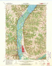
1967 · Prairie Du Chien
USGS Topo · 1:62,500