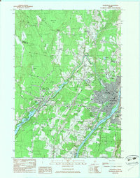
1982 Map of Waterville
USGS Topo · Published 1983About this map
The confluence of the Kennebec River, Sebasticook River, and Messalonskee Stream anchors this mid-century portrait of central Maine's industrial and academic hub. The urban centers of Waterville, Winslow, and Oakland are shown in high detail, illustrating the density of institutions such as Colby College and Thomas College alongside the critical infrastructure of the Maine Central railroad and Waterville Robert Lafleur Airport.
Find a feature on this map
54 named features on this map. Tap any name to fly to it.
Don’t see what you’re looking for? This feature index may not catch every label — zoom into the map to look around manually.
Map Details
Editions of this 1982 Waterville Map
3 editions found
Other maps of this area

1892 · Waterville
USGS Topo · 1:62,500

1892 · Augusta
USGS Topo · 1:62,500

1893 · Vassalboro
USGS Topo · 1:62,500

1894 · Norridgewock
USGS Topo · 1:62,500

1898 · Norridgewock
USGS Topo · 1:62,500

1898 · Vassalboro
USGS Topo · 1:62,500

1941 · Vassalboro
USGS Topo · 1:62,500

1941 · Augusta
USGS Topo · 1:62,500

1943 · Augusta
USGS Topo · 1:62,500

1943 · Vassalboro
USGS Topo · 1:62,500