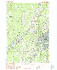
1982 Map of Waterville
USGS Topo · Published 1990About this map
Colby College and the industrial corridors of the Kennebec River dominate this early 1980s look at the heart of central Maine. The confluence of the Sebasticook River and the Kennebec defines the eastern boundary, where the Maine Central railroad lines trace the riverbanks through Waterville, Winslow, and Oakland. The landscape reveals a transition from the dense educational and civic centers, including the Maine Criminal Justice Academy and Thomas College, to the outlying rural character of Fairfield Center and Toulouse Corner.
Find a feature on this map
56 named features on this map. Tap any name to fly to it.
Don’t see what you’re looking for? This feature index may not catch every label — zoom into the map to look around manually.
Map Details
Editions of this 1982 Waterville Map
3 editions found
Other maps of this area

1892 · Waterville
USGS Topo · 1:62,500

1892 · Augusta
USGS Topo · 1:62,500

1893 · Vassalboro
USGS Topo · 1:62,500

1894 · Norridgewock
USGS Topo · 1:62,500

1898 · Norridgewock
USGS Topo · 1:62,500

1898 · Vassalboro
USGS Topo · 1:62,500

1941 · Vassalboro
USGS Topo · 1:62,500

1941 · Augusta
USGS Topo · 1:62,500

1943 · Augusta
USGS Topo · 1:62,500

1943 · Vassalboro
USGS Topo · 1:62,500