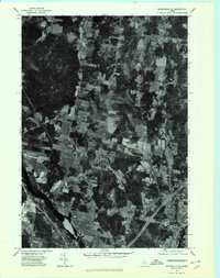
1975 Map of Waterville NE
USGS Topo · Published 1980About this map
Sebasticook River winds through the eastern portion of this Kennebec County landscape, defining the character of the riverfront near Clinton. The orthophotograph, derived from 1975 aerial photography, reveals the high-contrast patterns of woodlots and cleared agricultural fields that dominate the rural terrain. Along the southern edge, the settlement of Shawmut sits near the river's edge, while Morrison Corner serves as a central point for the local road network connecting these upland farms. The imagery provides a clear view of the mid-1970s land use, showing the exact boundaries of active timber and hay production before modern development began to alter the traditional landscape of this Maine corridor.
Find a feature on this map
6 named features on this map. Tap any name to fly to it.
Don’t see what you’re looking for? This feature index may not catch every label — zoom into the map to look around manually.
Map Details
Editions of this 1975 Waterville NE Map
This is the sole edition of this map. No revisions or reprints were ever made.
Other maps of this area

1892 · Waterville
USGS Topo · 1:62,500

1913 · Skowhegan
USGS Topo · 1:62,500

1926 · Burnham
USGS Topo · 1:62,500

1930 · Pittsfield
USGS Topo · 1:48,000

1932 · Pittsfield
USGS Topo · 1:62,500

1933 · Pittsfield
USGS Topo · 1:62,500

1943 · Waterville
USGS Topo · 1:62,500

1948 · Bangor
USGS Topo · 1:250,000

1955 · Pittsfield
USGS Topo · 1:62,500

1955 · Skowhegan
USGS Topo · 1:62,500