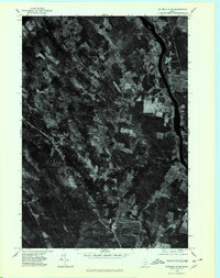
1975 Map of Waterville NW
USGS Topo · Published 1980About this map
North Fairfield and the rural lands of Somerset County are captured in this 1975 orthophotoquad, which utilizes aerial photography to document the landscape of central Maine. The imagery reveals a mosaic of active agricultural fields and dense woodlands, bisected by local road networks that converge at small crossroads such as Holway Corner. Along the eastern edge of the quadrangle, the wide Kennebec River serves as a primary geographic boundary, its dark ribbon of water contrasting with the organized patterns of human settlement at Hinckley. This aerial perspective provides a precise look at the land use and timber patterns of the mid-1970s, before later development altered the rural character of these river valley communities.
Find a feature on this map
4 named features on this map. Tap any name to fly to it.
Don’t see what you’re looking for? This feature index may not catch every label — zoom into the map to look around manually.
Map Details
Editions of this 1975 Waterville NW Map
This is the sole edition of this map. No revisions or reprints were ever made.
Other maps of this area

1892 · Waterville
USGS Topo · 1:62,500

1894 · Norridgewock
USGS Topo · 1:62,500

1898 · Norridgewock
USGS Topo · 1:62,500

1904 · Anson
USGS Topo · 1:62,500

1913 · Skowhegan
USGS Topo · 1:62,500

1943 · Norridgewock
USGS Topo · 1:62,500

1943 · Waterville
USGS Topo · 1:62,500

1948 · Bangor
USGS Topo · 1:250,000

1955 · Anson
USGS Topo · 1:62,500

1955 · Skowhegan
USGS Topo · 1:62,500