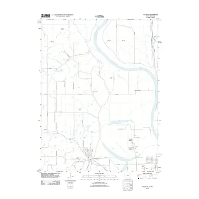
2012 Map of Wathena
USGS Topo · Published 2012About this map
Wathena and the winding course of the Missouri River anchor this 2012 survey, revealing the complex relationship between the waterway and the fertile lowlands of the river valley. The landscape is characterized by expansive agricultural tracts like Gladden Bottom and French Bottom, protected from the river's path by a network of drainage and transport routes. This map provides significant value for genealogical research, documenting several burial sites including Columbus Cem, Moskau Cem, and Mount Calvary Cem, which serve as markers for the area's rural history. Transportation and utility are evident in the presence of Rosecrans Memorial Airport and the grid-like system of county roads such as Sheridan Rd and 240th Rd. Water features like Browning Lake and Smith Cr delineate the natural drainage patterns of this border region, while the concentration of residential streets in Wathena contrasts with the surrounding agricultural bottoms.
Find a feature on this map
64 named features on this map. Tap any name to fly to it.
Don’t see what you’re looking for? This feature index may not catch every label — zoom into the map to look around manually.
Map Details
Editions of this 2012 Wathena Map
This is the sole edition of this map. No revisions or reprints were ever made.
Other maps of this area

1885 · Atchison
USGS Topo · 1:125,000

1888 · Atchison
USGS Topo · 1:125,000

1893 · Atchison
USGS Topo · 1:125,000

1924 · St. Joseph
USGS Topo · 1:62,500

1926 · Atchison
USGS Topo · 1:62,500

1926 · Saint Joseph
USGS Topo · 1:62,500

1926 · Oregon
USGS Topo · 1:62,500

1927 · Dearborn
USGS Topo · 1:62,500

1950 · Kansas City
USGS Topo · 1:250,000

1954 · Kansas City
USGS Topo · 1:250,000