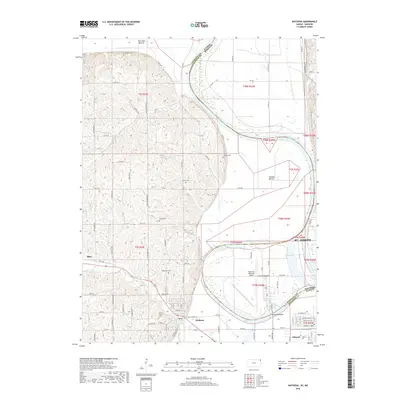
2018 Map of Wathena
USGS Topo · Published 2018About this map
The Missouri River carves a massive, looping boundary across this landscape, defining the state line between Kansas and Missouri. On the Missouri side, the wide alluvial flats of French Bottom are dominated by the runways of Rosecrans Memorial Airport, a significant aviation landmark near St. Joseph. Across the water in Kansas, the terrain shifts abruptly from the low-lying Gladden Bottom to the dissected loess bluffs near Wathena. This topographic variation created a distinct pattern of land use, where the fertile bottoms were cleared for large-scale agriculture while the higher ridges became sites for numerous community landmarks. Genealogists will find a high concentration of burial sites throughout these hills, including Bellemont Cem, Mount Calvary Cem, and Moskau Cem. Local transportation is anchored by historical crossings like the Browning Bridge near the oxbow of Browning Lake, connecting the rural uplands to the river-bottom economy.
Find a feature on this map
84 named features on this map. Tap any name to fly to it.
Don’t see what you’re looking for? This feature index may not catch every label — zoom into the map to look around manually.
Map Details
Editions of this 2018 Wathena Map
This is the sole edition of this map. No revisions or reprints were ever made.
Other maps of this area

1885 · Atchison
USGS Topo · 1:125,000

1888 · Atchison
USGS Topo · 1:125,000

1893 · Atchison
USGS Topo · 1:125,000

1924 · St. Joseph
USGS Topo · 1:62,500

1926 · Atchison
USGS Topo · 1:62,500

1926 · Saint Joseph
USGS Topo · 1:62,500

1926 · Oregon
USGS Topo · 1:62,500

1927 · Dearborn
USGS Topo · 1:62,500

1950 · Kansas City
USGS Topo · 1:250,000

1954 · Kansas City
USGS Topo · 1:250,000