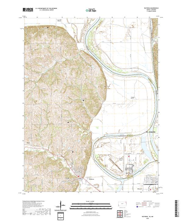
2022 Map of Wathena
USGS Topo · Published 2022About this map
The Missouri River defines the landscape here, carving a wide, serpentine path that separates Doniphan County, Kansas, from Buchanan County, Missouri. This hydrological boundary creates distinct alluvial plains such as French Bottom and Gladden Bottom, which dominate the eastern half of the survey. The western uplands are marked by an intricate network of rural roads like Saint Columbus Rd and Runnymede Rd, serving a series of established burial grounds including Columbus Cem and Bellemont Cem.
Find a feature on this map
80 named features on this map. Tap any name to fly to it.
Don’t see what you’re looking for? This feature index may not catch every label — zoom into the map to look around manually.
Map Details
Editions of this 2022 Wathena Map
This is the sole edition of this map. No revisions or reprints were ever made.
Other maps of this area

1885 · Atchison
USGS Topo · 1:125,000

1888 · Atchison
USGS Topo · 1:125,000

1893 · Atchison
USGS Topo · 1:125,000

1924 · St. Joseph
USGS Topo · 1:62,500

1926 · Atchison
USGS Topo · 1:62,500

1926 · Saint Joseph
USGS Topo · 1:62,500

1926 · Oregon
USGS Topo · 1:62,500

1927 · Dearborn
USGS Topo · 1:62,500

1950 · Kansas City
USGS Topo · 1:250,000

1954 · Kansas City
USGS Topo · 1:250,000