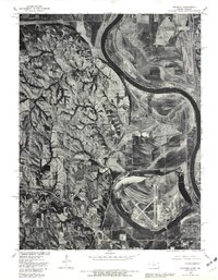
1980 Map of Wathena
USGS Topo · Published 1981About this map
The Missouri River defines the landscape of this 1980 orthophoto quadrangle, winding through a complex network of active channels and abandoned oxbows along the Kansas-Missouri border. The settlement of Wathena sits at the base of the western bluffs, while Elwwod occupies the flat floodplain to the east, illustrating how the river's historical path influenced early development in Doniphan County. Evidence of the valley's hydrological history is most visible in the large meander scar containing Browning Lake, which sits tucked within a sharp bend of the main river. To the northwest, the small settlement of Blair is positioned near the upland ridges, where the terrain shifts from the broad agricultural bottoms to more broken, wooded topography.
Find a feature on this map
12 named features on this map. Tap any name to fly to it.
Don’t see what you’re looking for? This feature index may not catch every label — zoom into the map to look around manually.
Map Details
Editions of this 1980 Wathena Map
This is the sole edition of this map. No revisions or reprints were ever made.
Other maps of this area

1885 · Atchison
USGS Topo · 1:125,000

1888 · Atchison
USGS Topo · 1:125,000

1893 · Atchison
USGS Topo · 1:125,000

1924 · St. Joseph
USGS Topo · 1:62,500

1926 · Atchison
USGS Topo · 1:62,500

1926 · Saint Joseph
USGS Topo · 1:62,500

1926 · Oregon
USGS Topo · 1:62,500

1927 · Dearborn
USGS Topo · 1:62,500

1950 · Kansas City
USGS Topo · 1:250,000

1954 · Kansas City
USGS Topo · 1:250,000