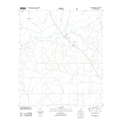
2011 Map of Watkins Bridge
USGS Topo · Published 2011About this map
Yellow River and its complex network of tributaries define the hydrology of this Covington County landscape, where the main channel meets North Creek and its associated North Creek Cutoff. The settlement of Shiloh sits in the northwest, anchored by Shiloh Cemetery along its namesake road. Further east, the hamlet of Huckaville is positioned near Huckabaa Pond, while the namesake Watkins Bridge crossing provides a central geographic landmark.
Find a feature on this map
50 named features on this map. Tap any name to fly to it.
Don’t see what you’re looking for? This feature index may not catch every label — zoom into the map to look around manually.
Map Details
Editions of this 2011 Watkins Bridge Map
This is the sole edition of this map. No revisions or reprints were ever made.
Other maps of this area

1949 · Crestview
USGS Topo · 1:62,500

1949 · Laurel Hill
USGS Topo · 1:62,500

1950 · Laurel Hill
USGS Topo · 1:62,500

1951 · Crestview
USGS Topo · 1:62,500

1953 · Andalusia
USGS Topo · 1:250,000

1957 · Andalusia
USGS Topo · 1:250,000

1957 · Pensacola
USGS Topo · 1:250,000

1959 · Pensacola
USGS Topo · 1:250,000

1960 · Pensacola
USGS Topo · 1:250,000

1971 · Carolina
USGS Topo · 1:24,000