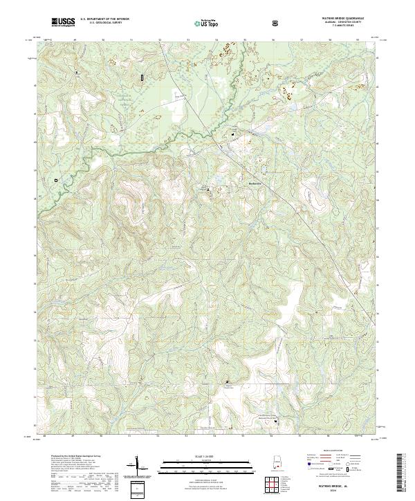
2024 Map of Watkins Bridge
USGS Topo · Published 2024About this map
Conecuh National Forest dominates the northern landscape of this Covington County quadrangle, where the Yellow River and North Creek carve through a terrain defined by family-named roads and scattered spiritual centers. The small settlement of Huckaville serves as a local waypoint near Huckabaa Pond, while the surrounding countryside is dotted with several houses of worship and their associated burial grounds. These sites, including Damascus Baptist Church Cem and Christian Home United Methodist Church Cem, provide critical anchors for genealogical research in this part of Alabama. The mapping of the local drainage system, from Larkin Creek in the west to Horsehead Creek and Fleming Creek in the southeast, illustrates the network of small branches that have historically shaped land use and property boundaries in this rural timber and agricultural region.
Find a feature on this map
74 named features on this map. Tap any name to fly to it.
Don’t see what you’re looking for? This feature index may not catch every label — zoom into the map to look around manually.
Map Details
Editions of this 2024 Watkins Bridge Map
This is the sole edition of this map. No revisions or reprints were ever made.
Other maps of this area

1949 · Crestview
USGS Topo · 1:62,500

1949 · Laurel Hill
USGS Topo · 1:62,500

1950 · Laurel Hill
USGS Topo · 1:62,500

1951 · Crestview
USGS Topo · 1:62,500

1953 · Andalusia
USGS Topo · 1:250,000

1957 · Andalusia
USGS Topo · 1:250,000

1957 · Pensacola
USGS Topo · 1:250,000

1959 · Pensacola
USGS Topo · 1:250,000

1960 · Pensacola
USGS Topo · 1:250,000

1971 · Carolina
USGS Topo · 1:24,000