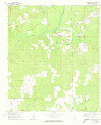
1971 Map of Watkins Bridge
USGS Topo · Published 1973About this map
Yellow River winds through the northern portion of this landscape, forming the centerpiece of a rural Covington County community defined by its watercourses and timberlands. Much of the northwest is managed as part of the Conecuh National Forest, where topographic details show the drainage patterns of Turner Branch and Bear Creek. Small settlements like Watkins Bridge and Huckaville serve as local hubs, characterized by a high density of country churches and burial grounds that anchor the social geography of the era.
Find a feature on this map
26 named features on this map. Tap any name to fly to it.
Don’t see what you’re looking for? This feature index may not catch every label — zoom into the map to look around manually.
Map Details
Editions of this 1971 Watkins Bridge Map
This is the sole edition of this map. No revisions or reprints were ever made.
Other maps of this area

1949 · Crestview
USGS Topo · 1:62,500

1949 · Laurel Hill
USGS Topo · 1:62,500

1950 · Laurel Hill
USGS Topo · 1:62,500

1951 · Crestview
USGS Topo · 1:62,500

1953 · Andalusia
USGS Topo · 1:250,000

1957 · Andalusia
USGS Topo · 1:250,000

1957 · Pensacola
USGS Topo · 1:250,000

1959 · Pensacola
USGS Topo · 1:250,000

1960 · Pensacola
USGS Topo · 1:250,000

1971 · Carolina
USGS Topo · 1:24,000