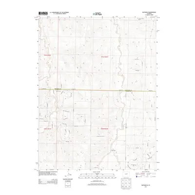
2013 Map of Watkins SE
USGS Topo · Published 2013About this map
Box Elder Creek and Coal Creek wind through this high plains landscape on the border of Arapahoe and Elbert counties. The terrain is defined by the subtle drainages of Hay Gulch, where residential development and ranching interests have begun to intersect with established agricultural tracts. Local education history is represented by the location of the Schley School along Co Road 29, serving as a central landmark for rural residents. Evidence of private aviation and specialized land use appears at the Harrington Ranch Airport in the northern portion of the quadrangle. Modern thoroughfares like Co Road 194 bisect the area, while smaller paths such as Running Creek Ranch Rd and Antelope Ridge provide access to the undulating hills and drainages that characterize this part of the Colorado interior.
Find a feature on this map
42 named features on this map. Tap any name to fly to it.
Don’t see what you’re looking for? This feature index may not catch every label — zoom into the map to look around manually.
Map Details
Editions of this 2013 Watkins SE Map
This is the sole edition of this map. No revisions or reprints were ever made.
Other maps of this area

1890 · East Denver
USGS Topo · 1:125,000

1894 · Castle Rock
USGS Topo · 1:125,000

1913 · Castle Rock
USGS Topo · 1:125,000

1939 · Coal Creek
USGS Topo · 1:24,000

1939 · Elizabeth
USGS Topo · 1:62,500

1940 · Piney Creek
USGS Topo · 1:24,000

1942 · Piney Creek
USGS Topo · 1:31,680

1942 · Coal Creek
USGS Topo · 1:31,680

1945 · Elizabeth
USGS Topo · 1:62,500

1953 · Denver
USGS Topo · 1:250,000