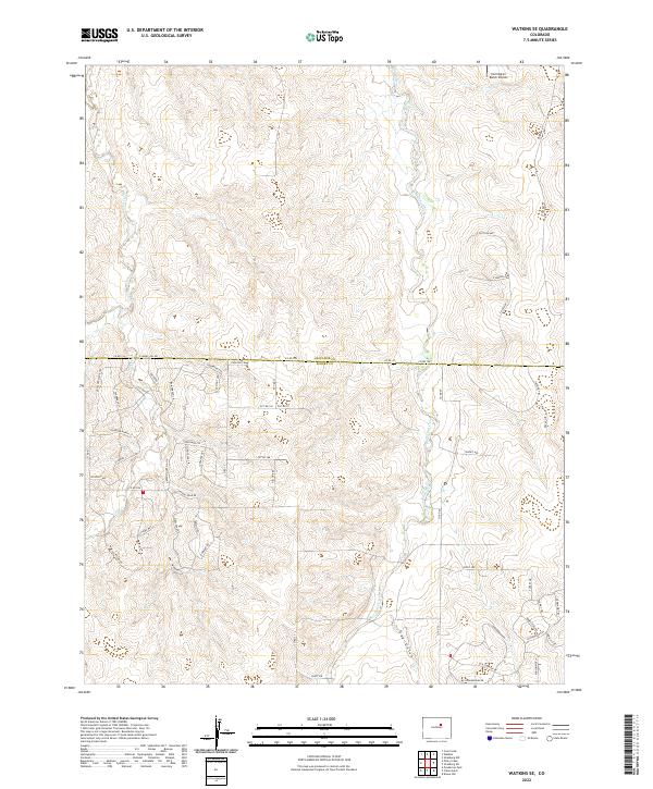
2022 Map of Watkins SE
USGS Topo · Published 2022About this map
Coal Creek and Box Elder Creek flow north through this high plains landscape at the border of Arapahoe and Elbert counties. The map captures a transition between traditional ranching land and modern residential development, visible in the winding network of roads such as Shenandoah Dr and Lariat Loop in the southeastern quadrant. The topography is defined by the subtle drainage of Hay Gulch and the presence of the Harrington Ranch Airport to the north.
Find a feature on this map
62 named features on this map. Tap any name to fly to it.
Don’t see what you’re looking for? This feature index may not catch every label — zoom into the map to look around manually.
Map Details
Editions of this 2022 Watkins SE Map
This is the sole edition of this map. No revisions or reprints were ever made.
Other maps of this area

1890 · East Denver
USGS Topo · 1:125,000

1894 · Castle Rock
USGS Topo · 1:125,000

1913 · Castle Rock
USGS Topo · 1:125,000

1939 · Coal Creek
USGS Topo · 1:24,000

1939 · Elizabeth
USGS Topo · 1:62,500

1940 · Piney Creek
USGS Topo · 1:24,000

1942 · Piney Creek
USGS Topo · 1:31,680

1942 · Coal Creek
USGS Topo · 1:31,680

1945 · Elizabeth
USGS Topo · 1:62,500

1953 · Denver
USGS Topo · 1:250,000