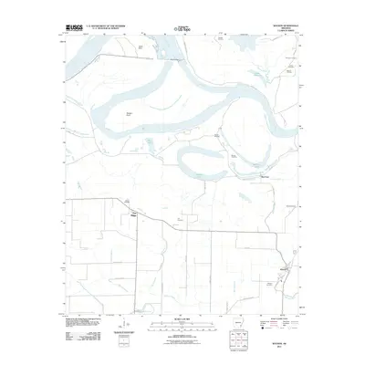
2011 Map of Watson
USGS Topo · Published 2011About this map
The Arkansas River dominates this portion of southeastern Arkansas, winding through a complex network of oxbow lakes and bayous north of the settlement at Watson. This landscape is defined by the tension between the river and the massive Levee system designed to manage its flow, creating distinct interior water bodies like Red Fork Lake, Belcoe Lake, and Lake Dumond. These basins, along with Menard Bayou and Oak Log Bayou, represent the geological legacy of a shifting river channel.
Find a feature on this map
42 named features on this map. Tap any name to fly to it.
Don’t see what you’re looking for? This feature index may not catch every label — zoom into the map to look around manually.
Map Details
Editions of this 2011 Watson Map
This is the sole edition of this map. No revisions or reprints were ever made.
Other maps of this area

1935 · Red Fork
USGS Topo · 1:62,500

1935 · Gillett
USGS Topo · 1:62,500

1939 · Henrico
USGS Topo · 1:62,500

1939 · Big Island
USGS Topo · 1:62,500

1948 · Helena
USGS Topo · 1:250,000

1950 · Helena
USGS Topo · 1:250,000

1953 · Greenwood
USGS Topo · 1:250,000

1954 · Henrico
USGS Topo · 1:62,500

1955 · Helena
USGS Topo · 1:250,000

1956 · Greenwood
USGS Topo · 1:250,000