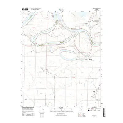
2014 Map of Watson
USGS Topo · Published 2014About this map
The Arkansas River dominates this landscape in Desha County, carving a wide path that separates the Arkansas County and Desha County boundary. The northern portion of the map is defined by the Arkansas Post National Memorial, a site of profound historical significance where several family-named burial grounds like Goose Cem and Menard Cem are situated near Menard Bayou. The terrain is a complex network of oxbow lakes and sloughs, including Lake Dumond, Belcoe Lake, and Red Fork Lake, which reflect the river's shifting course over time.
Find a feature on this map
60 named features on this map. Tap any name to fly to it.
Don’t see what you’re looking for? This feature index may not catch every label — zoom into the map to look around manually.
Map Details
Editions of this 2014 Watson Map
This is the sole edition of this map. No revisions or reprints were ever made.
Other maps of this area

1935 · Red Fork
USGS Topo · 1:62,500

1935 · Gillett
USGS Topo · 1:62,500

1939 · Henrico
USGS Topo · 1:62,500

1939 · Big Island
USGS Topo · 1:62,500

1948 · Helena
USGS Topo · 1:250,000

1950 · Helena
USGS Topo · 1:250,000

1953 · Greenwood
USGS Topo · 1:250,000

1954 · Henrico
USGS Topo · 1:62,500

1955 · Helena
USGS Topo · 1:250,000

1956 · Greenwood
USGS Topo · 1:250,000