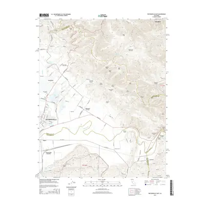
2015 Map of Watsonville East
USGS Topo · Published 2015About this map
Watsonville and the surrounding agricultural lowlands meet the rising southern slopes of the Santa Cruz Mountains in this modern topographic survey. The landscape is defined by the winding course of the Pajaro River, which forms the boundary between Santa Cruz Co and Monterey Co. To the north, the foothills are marked by numerous named drainages and ridges, including Casserly Ridge and Arano Canyon, while the San Andreas Fault cuts a distinct northwest-to-southeast line through the center of the hills. Settlement patterns are concentrated in the valley, with residential and commercial clusters at Interlaken and Johnston Corner. Infrastructure such as the Pajaro Quarry near Logan and the significant rail junction at Watsonville Junction reflect the area's ongoing industrial and transit importance. Genealogists will find local landmarks like Pajaro Valley Memorial Park and Saint Francis Cemetery situated amongst the orchards and lakes of the lower basin.
Find a feature on this map
125 named features on this map. Tap any name to fly to it.
Don’t see what you’re looking for? This feature index may not catch every label — zoom into the map to look around manually.
Map Details
Editions of this 2015 Watsonville East Map
This is the sole edition of this map. No revisions or reprints were ever made.
Other maps of this area

1912 · Capitola
USGS Topo · 1:62,500

1914 · Capitola
USGS Topo · 1:62,500

1915 · San Juan Bautista
USGS Topo · 1:48,000

1916 · New Almaden
USGS Topo · 1:48,000

1917 · Morgan Hill
USGS Topo · 1:62,500

1917 · San Juan Bautista
USGS Topo · 1:62,500

1919 · New Almaden
USGS Topo · 1:62,500

1939 · Morgan Hill
USGS Topo · 1:62,500

1939 · San Juan Bautista
USGS Topo · 1:62,500

1940 · San Juan Bautista
USGS Topo · 1:62,500