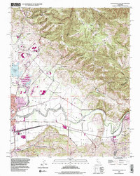
1995 Map of Watsonville East
USGS Topo · Published 1998About this map
Pajaro Valley agriculture and the complex geography of the San Andreas Rift Zone define this landscape on the border of Santa Cruz, Monterey, and Santa Clara counties. In the mid-1990s, the fertile basin around Watsonville supported a dense network of water bodies including College Lake, Kelly Lake, and Lake Tynan. To the east, the terrain rises sharply into the Las Animas Mountains, where Mt Madonna County Park overlooks Hecker Pass. The map documents a significant intersection of transport and community history, featuring the Southern Pacific rail lines at Watsonville Junction and Aromas. Genealogical interests are served by the inclusion of Pajaro Valley Memorial Park, St Francis Cem, and several local institutions like Salsipuedes School. Smaller nodes of settlement like Johnston Corner and the historical location of Thompsons Grove provide specific points of reference within the valley floor's rural and residential mix.
Find a feature on this map
71 named features on this map. Tap any name to fly to it.
Don’t see what you’re looking for? This feature index may not catch every label — zoom into the map to look around manually.
Map Details
Editions of this 1995 Watsonville East Map
2 editions found
Other maps of this area

1912 · Capitola
USGS Topo · 1:62,500

1914 · Capitola
USGS Topo · 1:62,500

1915 · San Juan Bautista
USGS Topo · 1:48,000

1916 · New Almaden
USGS Topo · 1:48,000

1917 · Morgan Hill
USGS Topo · 1:62,500

1917 · San Juan Bautista
USGS Topo · 1:62,500

1919 · New Almaden
USGS Topo · 1:62,500

1939 · Morgan Hill
USGS Topo · 1:62,500

1939 · San Juan Bautista
USGS Topo · 1:62,500

1940 · San Juan Bautista
USGS Topo · 1:62,500