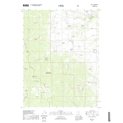
2020 Map of Wattis
USGS Topo · Published 2020About this map
Wattis sits at the foot of the Wasatch Plateau, serving as a focal point for this survey along the border of Carbon and Emery counties. The landscape is defined by its high-altitude topography, where Gentry Mtn and Hoag Ridge overlook the transition from the Manti-La Sal National Forest to the mining-influenced lowlands. The distribution of infrastructure, including the Wattis Hwy and the Star Point Mine Rd, reflects the area's industrial legacy, connecting the mountain benches to the drainages of Serviceberry Cr and Right Fork Miller Cr. Researchers can trace the complex network of ridge-top trails and access roads such as Telephone Bench Rd and Benches Rd, which traverse features like Lone Pine Tree Ridge and Wiregrass Bench. This 2020 edition provides a clear record of the modern terrain, from the sharp drops of The Steeps to the remote expanses of North Spring Canyon.
Find a feature on this map
46 named features on this map. Tap any name to fly to it.
Don’t see what you’re looking for? This feature index may not catch every label — zoom into the map to look around manually.
Map Details
Editions of this 2020 Wattis Map
This is the sole edition of this map. No revisions or reprints were ever made.
Other maps of this area

1885 · Manti
USGS Topo · 1:250,000

1886 · Price River
USGS Topo · 1:250,000

1895 · Manti
USGS Topo · 1:250,000

1896 · Price River
USGS Topo · 1:250,000

1914 · Castle Gate
USGS Topo · 1:62,500

1916 · Castle Gate
USGS Topo · 1:62,500

1923 · Scofield
USGS Topo · 1:62,500

1923 · Hiawatha
USGS Topo · 1:62,500

1925 · Scofield
USGS Topo · 1:62,500

1925 · Hiawatha
USGS Topo · 1:62,500