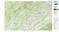
1981 Map of Watts Bar Lake
USGS Topo · Published 1984About this map
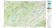
Watts Bar Lake and the winding Tennessee River dominate this 1980s landscape, illustrating the profound impact of the Tennessee Valley Authority on the region's topography. The map details the complex shoreline created by the impoundment of Fort Loudoun Lake, Tellico Lake, and Chickamauga Lake, which reshaped the valleys between the Cumberland Escarpment and the Great Smoky Mountains foothills.
Find a feature on this map
58 named features on this map. Tap any name to fly to it.
Don’t see what you’re looking for? This feature index may not catch every label — zoom into the map to look around manually.
Map Details
Editions of this 1981 Watts Bar Lake Map
2 editions found
Other maps of this area

1886 · Cleveland
USGS Topo · 1:125,000

1886 · Knoxville
USGS Topo · 1:125,000

1887 · Kingston
USGS Topo · 1:125,000

1888 · Chattanooga
USGS Topo · 1:125,000

1891 · Kingston
USGS Topo · 1:125,000

1892 · Pikeville
USGS Topo · 1:125,000

1892 · Cleveland
USGS Topo · 1:125,000

1892 · Knoxville
USGS Topo · 1:125,000

1893 · Chattanooga
USGS Topo · 1:125,000

1893 · Murphy
USGS Topo · 1:125,000