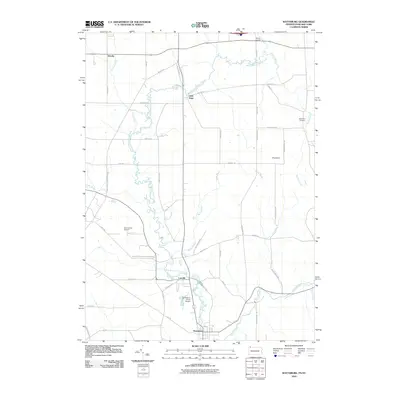
2010 Map of Wattsburg
USGS Topo · Published 2010About this map
West Branch French Creek meanders southward through this rural landscape at the intersection of Pennsylvania and New York, anchoring a series of small agricultural and residential clusters. Small settlements like Little Hope, Lowville, and Wattsburg follow the watercourse and the winding path of Old Route 89, illustrating the valley's long-standing reliance on these corridors for transport and settlement. The terrain is marked by distinctive glacial Drumlins in the eastern portion of the quadrangle, which dictate the placement of local roads like Weeks Valley Rd and Macedonia Rd.
Find a feature on this map
49 named features on this map. Tap any name to fly to it.
Don’t see what you’re looking for? This feature index may not catch every label — zoom into the map to look around manually.
Map Details
Editions of this 2010 Wattsburg Map
This is the sole edition of this map. No revisions or reprints were ever made.
Other maps of this area

1905 · Clymer
USGS Topo · 1:62,500

1913 · North East
USGS Topo · 1:62,500

1915 · North East
USGS Topo · 1:62,500

1929 · Corry
USGS Topo · 1:48,000

1929 · Union City
USGS Topo · 1:62,500

1932 · Corry
USGS Topo · 1:62,500

1932 · Union City
USGS Topo · 1:62,500

1939 · Clymer
USGS Topo · 1:62,500

1941 · Clymer
USGS Topo · 1:62,500

1943 · North East
USGS Topo · 1:62,500