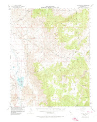
1958 Map of Waucoba Mtn
USGS Topo · Published 1973About this map
The Southern Pacific Railroad and the Owens River define the western floor of this Inyo County landscape, a stark contrast to the high elevations of the Inyo National Forest. This mapping, based on 1940s aerial photography and 1950s field surveys, captures a complex network of high-altitude mining and ranching interests. Mineral exploration is well-documented throughout the mountains, with sites such as the Montezuma Mine, Riche Mine, and Overholtz Mine dotting the terrain. Higher elevations include notable flats like Harkless Flat, Papoose Flat, and Squaw Flat, which provide level ground amidst the high peaks of Waucoba Mtn and Andrews Mtn. Near the river, the Tinemaha Reservoir stands as a significant hydrological feature, while the presence of the Graham Ranch (Site) and Toll House suggests the early routes of settlement and commerce through the canyons.
Find a feature on this map
39 named features on this map. Tap any name to fly to it.
Don’t see what you’re looking for? This feature index may not catch every label — zoom into the map to look around manually.
Map Details
Editions of this 1958 Waucoba Mtn Map
2 editions found
Other maps of this area

1907 · Mt. Whitney
USGS Topo · 1:125,000

1908 · Lida
USGS Topo · 1:250,000

1908 · Ballarat
USGS Topo · 1:250,000

1913 · Bishop
USGS Topo · 1:125,000

1913 · Lida
USGS Topo · 1:250,000

1913 · Ballarat
USGS Topo · 1:250,000

1919 · Mt. Whitney
USGS Topo · 1:125,000

1937 · Mt. Whitney
USGS Topo · 1:125,000

1947 · Mariposa
USGS Topo · 1:250,000

1948 · Death Valley
USGS Topo · 1:250,000