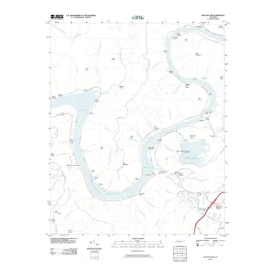
2010 Map of Wauhatchie
USGS Topo · Published 2010About this map
McNabb Mines and Aetna Mines are situated along the lower slopes of the Cumberland Plateau, illustrating the industrial legacy of extraction that shaped this riverine landscape. The Tennessee River dominates the topography as it winds through deep gorges, creating hazardous navigational points like The Suck and Suck Shoals. This 2010 survey highlights a significant shift in land use, where former industrial sites and remote mountain gaps coexist with modern infrastructure like the Raccoon Mountain Pumped Station Dam and its associated Raccoon Mountain Pumped Station Reserve.
Find a feature on this map
95 named features on this map. Tap any name to fly to it.
Don’t see what you’re looking for? This feature index may not catch every label — zoom into the map to look around manually.
Map Details
Editions of this 2010 Wauhatchie Map
This is the sole edition of this map. No revisions or reprints were ever made.
Other maps of this area

1886 · Ringgold
USGS Topo · 1:125,000

1886 · Stevenson
USGS Topo · 1:125,000

1888 · Chattanooga
USGS Topo · 1:125,000

1892 · Ringgold
USGS Topo · 1:125,000

1892 · Stevenson
USGS Topo · 1:125,000

1893 · Chattanooga
USGS Topo · 1:125,000

1895 · Stevenson
USGS Topo · 1:125,000

1895 · Sewanee
USGS Topo · 1:125,000

1936 · Shellmound
USGS Topo · 1:24,000

1936 · Whitwell
USGS Topo · 1:24,000