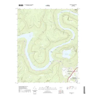
2019 Map of Wauhatchie
USGS Topo · Published 2019About this map
The Tennessee River winds through a dramatic landscape of ridges and deep hollows, carving a path between Elder Mtn and the heights of Signal Mountain. This 2019 survey captures the area as it balances natural conservation with significant industrial engineering, notably the Raccoon Mountain Pumped Storage Dam and Reservoir atop Grindstone Ridge. The map documents numerous small family cemeteries, such as Francis Cem and Kellys Ferry Cem, which anchor the historical genealogy of the riverbanks.
Find a feature on this map
103 named features on this map. Tap any name to fly to it.
Don’t see what you’re looking for? This feature index may not catch every label — zoom into the map to look around manually.
Map Details
Editions of this 2019 Wauhatchie Map
This is the sole edition of this map. No revisions or reprints were ever made.
Other maps of this area

1886 · Ringgold
USGS Topo · 1:125,000

1886 · Stevenson
USGS Topo · 1:125,000

1888 · Chattanooga
USGS Topo · 1:125,000

1892 · Ringgold
USGS Topo · 1:125,000

1892 · Stevenson
USGS Topo · 1:125,000

1893 · Chattanooga
USGS Topo · 1:125,000

1895 · Stevenson
USGS Topo · 1:125,000

1895 · Sewanee
USGS Topo · 1:125,000

1936 · Shellmound
USGS Topo · 1:24,000

1936 · Whitwell
USGS Topo · 1:24,000