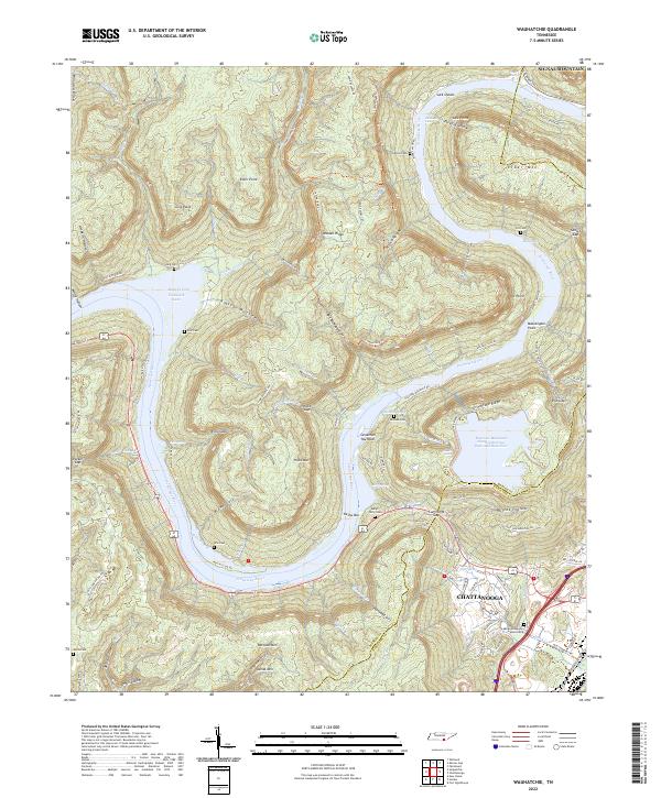
2022 Map of Wauhatchie
USGS Topo · Published 2022About this map
The Tennessee River winds through a dramatic landscape of steep ridges and deep gulfs west of Chattanooga, where the modern engineering of the Raccoon Mountain Pumped Storage Dam and Reservoir dominates the eastern heights. This area of Marion County is defined by the sharp relief of Walden Ridge and Elder Mountain, which hem in the river as it flows through Suck Shoals and past Savannah Towhead. The topography reveals a history of isolated family settlements and mountain life, evidenced by the numerous small cemeteries found across the terrain, including Francis Cemetery, Pot Cemetery, and Aetna Cemetery.
Find a feature on this map
99 named features on this map. Tap any name to fly to it.
Don’t see what you’re looking for? This feature index may not catch every label — zoom into the map to look around manually.
Map Details
Editions of this 2022 Wauhatchie Map
This is the sole edition of this map. No revisions or reprints were ever made.
Other maps of this area

1886 · Ringgold
USGS Topo · 1:125,000

1886 · Stevenson
USGS Topo · 1:125,000

1888 · Chattanooga
USGS Topo · 1:125,000

1892 · Ringgold
USGS Topo · 1:125,000

1892 · Stevenson
USGS Topo · 1:125,000

1893 · Chattanooga
USGS Topo · 1:125,000

1895 · Stevenson
USGS Topo · 1:125,000

1895 · Sewanee
USGS Topo · 1:125,000

1936 · Shellmound
USGS Topo · 1:24,000

1936 · Whitwell
USGS Topo · 1:24,000