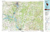
1984 Map of Wausau
USGS Topo · Published 1990About this map
Rib Mountain dominates the central landscape of this Marathon County region, standing as a prominent landmark above the Wisconsin River valley. The river serves as the primary corridor for settlement and industry, connecting Wausau, Schofield, Rothschild, and Mosinee. The mid-1980s infrastructure is well-defined, showing the paths of the Chicago and North Western and Soo Line railroads alongside major routes like U S 51.
Find a feature on this map
201 named features on this map. Tap any name to fly to it.
Don’t see what you’re looking for? This feature index may not catch every label — zoom into the map to look around manually.
Map Details
Editions of this 1984 Wausau Map
This is the sole edition of this map. No revisions or reprints were ever made.
Other maps of this area

1899 · Wausau
USGS Topo · 1:125,000

1902 · Wausau
USGS Topo · 1:125,000

1902 · Marathon
USGS Topo · 1:125,000

1951 · Doering
USGS Topo · 1:48,000

1951 · Athens
USGS Topo · 1:48,000

1951 · Merrill
USGS Topo · 1:48,000

1951 · Hamburg
USGS Topo · 1:48,000

1952 · Antigo
USGS Topo · 1:48,000

1952 · White Lake
USGS Topo · 1:48,000

1953 · Wausau
USGS Topo · 1:48,000