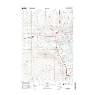
2015 Map of Wausau West
USGS Topo · Published 2015About this map
Wausau and its surrounding communities are anchored by the industrial and natural geography of the Wisconsin River in this 2015 study. The map illustrates the transition from the urban density of the city center to the prominent terrain of Rib Mtn and Mosinee Hill to the southwest. Significant cultural and educational institutions are well-documented, including the Univ of Wisconsin - Marathon County and Northcentral Technical Coll. The river’s path is flanked by residential growth and aviation infrastructure at the Wausau Downtown Airport, while the southern reaches show the expansion of Schofield and Rothschild. This era of the landscape is defined by the coexistence of heavy industry, represented by the CN railroad and local Gravel Pits, alongside the preserved wetlands of the Ninemile Swamp and the recreational waters of Lake Wausau.
Find a feature on this map
147 named features on this map. Tap any name to fly to it.
Don’t see what you’re looking for? This feature index may not catch every label — zoom into the map to look around manually.
Map Details
Editions of this 2015 Wausau West Map
This is the sole edition of this map. No revisions or reprints were ever made.
Other maps of this area

1899 · Wausau
USGS Topo · 1:125,000

1902 · Wausau
USGS Topo · 1:125,000

1902 · Marathon
USGS Topo · 1:125,000

1951 · Merrill
USGS Topo · 1:48,000

1951 · Hamburg
USGS Topo · 1:48,000

1953 · Wausau
USGS Topo · 1:48,000

1953 · Marathon
USGS Topo · 1:48,000

1954 · Iron Mountain
USGS Topo · 1:250,000

1955 · Green Bay
USGS Topo · 1:250,000

1959 · Iron Mountain
USGS Topo · 1:250,000