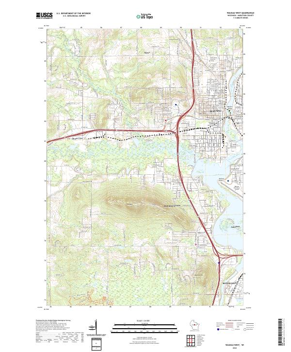
2022 Map of Wausau West
USGS Topo · Published 2022About this map
The Wisconsin River serves as the eastern corridor of this modern survey, anchoring the industrial and civic development of Wausau, Schofield, and Rothschild. To the west, the landscape is defined by the significant rise of Rib Mtn and Mosinee Hill, which overlook the confluence of the Big Rib River and the Little Rib River. This area balances urban density with expansive natural features, from the academic campuses of Northcentral Technical College and the University of Wisconsin-Marathon County to the wetlands of Ninemile Swamp. The river's path is marked by islands and human-made reservoirs like Lake Wausau, while the Wausau Downtown Airport occupies a prominent position at Asylum Point. This map provides a detailed view of the infrastructure connecting these communities, including the residential sprawl of Maine and the recreational waters of Sunny Vale Lake.
Find a feature on this map
92 named features on this map. Tap any name to fly to it.
Don’t see what you’re looking for? This feature index may not catch every label — zoom into the map to look around manually.
Map Details
Editions of this 2022 Wausau West Map
This is the sole edition of this map. No revisions or reprints were ever made.
Other maps of this area

1899 · Wausau
USGS Topo · 1:125,000

1902 · Wausau
USGS Topo · 1:125,000

1902 · Marathon
USGS Topo · 1:125,000

1951 · Merrill
USGS Topo · 1:48,000

1951 · Hamburg
USGS Topo · 1:48,000

1953 · Wausau
USGS Topo · 1:48,000

1953 · Marathon
USGS Topo · 1:48,000

1954 · Iron Mountain
USGS Topo · 1:250,000

1955 · Green Bay
USGS Topo · 1:250,000

1959 · Iron Mountain
USGS Topo · 1:250,000