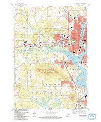
1993 Map of Wausau West
USGS Topo · Published 1993About this map
Rib Mountain dominates the landscape south of the Big Rib River, providing a massive topographic anchor for the western expansion of Wausau. This early 1990s survey illustrates a community deeply integrated with its river system, where the Wisconsin River widens into Lake Wausau, creating a complex shoreline dotted with landmarks like Asylum Point and Barkers Island. The urban core is dense with civic and religious institutions, ranging from St Matthews Sch to the County Fairground, while the Wisconsin Central railroad tracks trace the industrial corridor along the eastern bank.
Find a feature on this map
66 named features on this map. Tap any name to fly to it.
Don’t see what you’re looking for? This feature index may not catch every label — zoom into the map to look around manually.
Map Details
Editions of this 1993 Wausau West Map
This is the sole edition of this map. No revisions or reprints were ever made.
Other maps of this area

1899 · Wausau
USGS Topo · 1:125,000

1902 · Wausau
USGS Topo · 1:125,000

1902 · Marathon
USGS Topo · 1:125,000

1951 · Merrill
USGS Topo · 1:48,000

1951 · Hamburg
USGS Topo · 1:48,000

1953 · Wausau
USGS Topo · 1:48,000

1953 · Marathon
USGS Topo · 1:48,000

1954 · Iron Mountain
USGS Topo · 1:250,000

1955 · Green Bay
USGS Topo · 1:250,000

1959 · Iron Mountain
USGS Topo · 1:250,000