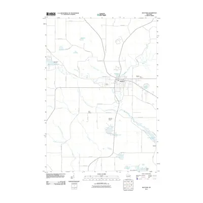
2010 Map of Wautoma
USGS Topo · Published 2010About this map
Wautoma serves as the central hub in this early 21st-century landscape, where the White River and its various branches create a complex network of waterways and impoundments. The geography is defined by several water control structures, including the Upper White River Dam and Wautoma Dam, which have shaped the local ponds and reservoirs like Wautoma Pond and Lower White River Pond 83. These water features, alongside numerous glacial lakes such as Round Lake, Turtle Lake, and Bughs Lake, highlight the area's transition from river-driven industry to a modern mix of aviation and recreation, anchored by the Wautoma Municipal Airport.
Find a feature on this map
68 named features on this map. Tap any name to fly to it.
Don’t see what you’re looking for? This feature index may not catch every label — zoom into the map to look around manually.
Map Details
Editions of this 2010 Wautoma Map
This is the sole edition of this map. No revisions or reprints were ever made.
Other maps of this area

1915 · Neshkoro
USGS Topo · 1:48,000

1918 · Neshkoro
USGS Topo · 1:62,500

1955 · Green Bay
USGS Topo · 1:250,000

1957 · Madison
USGS Topo · 1:250,000

1959 · Wautoma
USGS Topo · 1:48,000

1960 · Madison
USGS Topo · 1:250,000

1961 · Redgranite
USGS Topo · 1:62,500

1961 · Montello
USGS Topo · 1:62,500

1961 · Wild Rose
USGS Topo · 1:24,000

1961 · Spring Lake
USGS Topo · 1:24,000