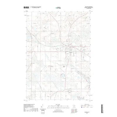
2018 Map of Wautoma
USGS Topo · Published 2018About this map
Wautoma serves as the focal point of this Central Wisconsin landscape, where the W Br White River and White River converge amidst a dense network of glacial lakes and wetlands. The town's layout is defined by its historic core near Bird Cr and Bowers Cr, extending toward the Wautoma Municipal Airport. The surrounding terrain is characterized by numerous small bodies of water, including Bughs Lake, Witters Lake, and the expansive Wautoma Swamp to the northeast. Genealogists will find significant value in the distribution of local burial grounds such as Wautoma Cem, Hope Cem, and the more remote North Dakota Cem and Raymond Cem. This survey illustrates a modern rural infrastructure where established township roads like Cottonville Ave and Bighorn Dr navigate a complex hydrologic system of creeks and kettle lakes.
Find a feature on this map
61 named features on this map. Tap any name to fly to it.
Don’t see what you’re looking for? This feature index may not catch every label — zoom into the map to look around manually.
Map Details
Editions of this 2018 Wautoma Map
This is the sole edition of this map. No revisions or reprints were ever made.
Other maps of this area

1915 · Neshkoro
USGS Topo · 1:48,000

1918 · Neshkoro
USGS Topo · 1:62,500

1955 · Green Bay
USGS Topo · 1:250,000

1957 · Madison
USGS Topo · 1:250,000

1959 · Wautoma
USGS Topo · 1:48,000

1960 · Madison
USGS Topo · 1:250,000

1961 · Redgranite
USGS Topo · 1:62,500

1961 · Montello
USGS Topo · 1:62,500

1961 · Wild Rose
USGS Topo · 1:24,000

1961 · Spring Lake
USGS Topo · 1:24,000